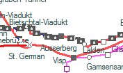
The tourist map of the area of Ausserberg and the distances, times and elevation profile of the Bahnwanderweg (railway hiking trail)

Photo by: Takács Bence
Captured at: 2014:07:18 16:50:35
915 views
Photo by Takács Bence
Copyright 2005-2014. www.benbe.hu. Railway photography gallery of Takács Bence.


